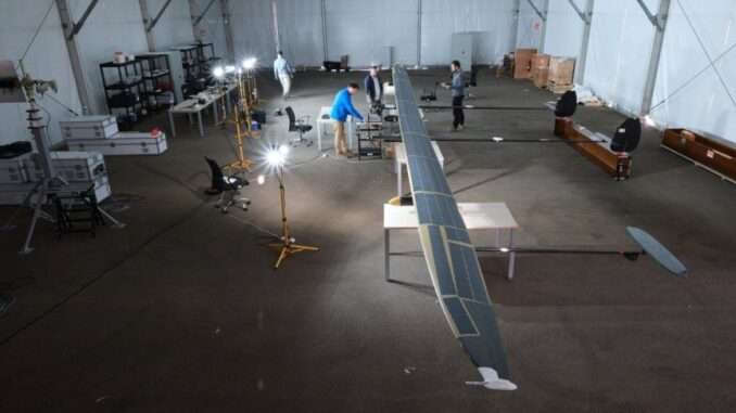
Mira Aerospace, a subsidiary of Space42 (ADX: SPACE42)—the UAE’s leading AI-powered SpaceTech champion—has achieved a historic milestone by conducting the first High Altitude Platform Systems (HAPS) flight in Europe under civilian operational approval.
The mission, executed by Mira Aerospace’s flagship ApusNeo18 HAPS model for Telespazio Ibérica (a Leonardo group company), marks a paradigm shift in how HAPS technology can safely integrate into civilian airspace to deliver mission-critical, real-time intelligence for environmental and emergency monitoring.
Strategic Leadership in Geospatial Intelligence
Khaled Al Marzooqi, CEO of Mira Aerospace, Space42, commented:
“Securing Europe’s first HAPS flight with civilian approval underscores the international momentum behind Space42’s vision to become the global partner of choice for premium geospatial intelligence. In the face of intensifying wildfire threats, our HAPS platforms provide the agility, persistence, and precision required to maintain a comprehensive, real-time tactical view of moving fire fronts. This operation for Telespazio Ibérica validates the commercial and operational value of our AI-enabled data in empowering governments and first responders to accelerate emergency response times while significantly reducing costs.”
Carlos Fernández de la Peña, CEO of Telespazio Ibérica, added:
“This inaugural flight elevates our project to an entirely new level. Beyond navigating complex regulatory frameworks, we are demonstrating unparalleled technological capabilities in monitoring and neutralizing ‘sixth-generation’ wildfires—catastrophes that have become increasingly devastating. This is a leap forward for European civil protection.”
HAPS: The Future of Wildfire Response
Part of the ISSEC program—a joint venture between Telespazio Ibérica and Pegasus Aero Group—this mission focuses on modernizing Spain’s wildfire-response infrastructure. HAPS bridge the gap between satellites and traditional aircraft, offering satellite-like persistence with aircraft-level flexibility. By transmitting high-resolution electro-optical and infrared (EO/IR) imagery in real-time, the ApusNeo18 serves as a vital tool for national infrastructure protection and disaster management.
Operational Excellence & Flight Logistics
The ApusNeo18 took flight on Friday, December 12, 2025, from the Fuerteventura Technology Park spaceport—Europe’s premier facility for such operations. The aircraft’s technical specifications highlight its advanced engineering:
- Wingspan: 18 meters.
- Length: 12 meters.
- Weight: ~45 kilograms (Ultralight carbon-fiber architecture).
During this phase, the aircraft successfully climbed to 2,000 feet, with subsequent missions planned over Gran Canaria. Operations will follow a segmented validation approach, progressively increasing flight ceilings to 16,000 feet and extending endurance to 48 hours of continuous stratospheric flight.
The data collected during these missions will form the foundation for future commercial stratospheric services, solidifying Mira Aerospace’s role in the global civil protection ecosystem.


Be the first to comment